Blog Satellite Navigation
ISRO's NVS-03 Restores NavIC: Lessons for Fleet Tracking
On this page· 7 sections
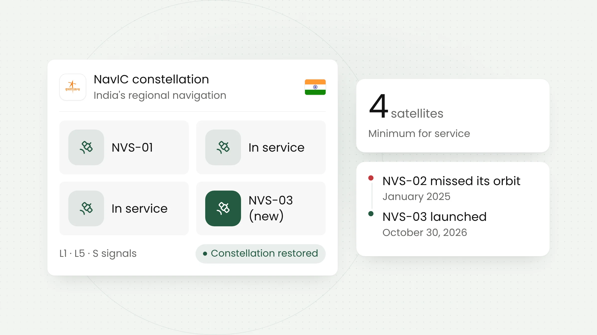
The Indian Space Research Organisation (ISRO) launched the NVS-03 navigation satellite late on Friday, October 30, 2026, and placed it in its intended orbit. The addition brings NavIC, India’s regional navigation system, back to its minimum operational configuration of four satellites after a long stretch with too few working spacecraft.
The NVS-03 launch and NavIC’s recovery
The GSLV-F18 rocket lifted off from the second launch pad at the Satish Dhawan Space Centre in Sriharikota at 11:51 p.m. India time, which was 1:21 a.m. on Saturday in Jakarta. According to the PTI report carried by The Tribune, the flight lasted about 18 minutes. All three stages performed as expected, including the cryogenic upper stage, and the satellite was released into a geosynchronous transfer orbit with a perigee of 170 km and an apogee of 37,023 km.
The 2,232 kg satellite will use its own propulsion to climb to its final geostationary slot at 32.5 degrees East. This was the 20th flight of the GSLV. ISRO chairman V. Narayanan said the mission was completed with the shortest gap yet between two GSLV missions, 56 days.
Four satellites as the baseline
NavIC (Navigation with Indian Constellation) is India’s own positioning system. Its service area covers the Indian landmass and a region extending about 1,500 km beyond the country’s borders, according to ISRO’s mission page. GPS serves the whole planet; NavIC was designed as a regional system.
Before this launch, Narayanan said, only three satellites, including NVS-01, were working. NVS-03 makes it four, the minimum needed to run position, navigation and timing services. Narayanan described NavIC as a “strategic national asset which provides independent access to Position, Navigation, Timing services”.
The system’s condition has drawn scrutiny in India for some time. The Week reported that, according to a government reply to Parliament in March 2026, eight of the eleven NavIC satellites ever launched were still working, but only three were sending proper navigation signals. Several first-generation satellites had problems with their atomic clocks.
How satellite navigation works, and why the L1 signal matters
Each navigation satellite continuously broadcasts its position and a highly precise time stamp from its onboard atomic clocks. A receiver in a phone or tracker works out its distance to each satellite from how long the signal took to arrive. As a technical explainer from DigiKey puts it, a receiver can estimate its position once it knows the distance to at least four satellites.
That makes clock accuracy central to the service. NVS-03 carries an indigenous rubidium atomic clock alongside clocks bought from outside suppliers, according to ISRO. Narayanan said one Indian-built atomic clock was already in orbit.
NVS-03 transmits on three frequency bands: L1, L5 and S. The L1 band is the change users are most likely to notice. According to The Week, L1 is the band most phones and small devices already use to receive GPS. Signals on this band make NavIC easier to pick up for phones, smartwatches and low-power trackers, provided their receiver chips support NavIC’s signal format.
Many systems in one receiver
Several satellite navigation systems are now in service. DigiKey lists the United States’ GPS, Europe’s Galileo, Russia’s GLONASS, China’s BeiDou and Japan’s QZSS. Modern receiver modules can track several of them at once, an approach known as multi-constellation or multi-GNSS.
DigiKey says such receivers offer better availability of position, navigation and timing signals, higher accuracy and integrity, and more resilient applications. The difference shows up where open sky is limited, such as between tall buildings, in container-packed ports or in valleys.
India positions NavIC for both strategic and civilian use. The PTI report cites civilian uses such as real-time tracking of trains, vehicles and ships. NavIC also supports the “one nation, one time” project to standardise Indian Standard Time, backed by the Legal Metrology (Indian Standard Time) Rules, 2026.
Lessons from the NVS-02 failure
NavIC’s recovery was delayed because the previous satellite, NVS-02, never reached its slot. It launched on a GSLV-F15 rocket on January 29, 2025, and arrived in transfer orbit normally. The problem came when the satellite had to raise its orbit. ISRO said the valves that feed oxidiser to the main engine did not open, so the engine could not fire.
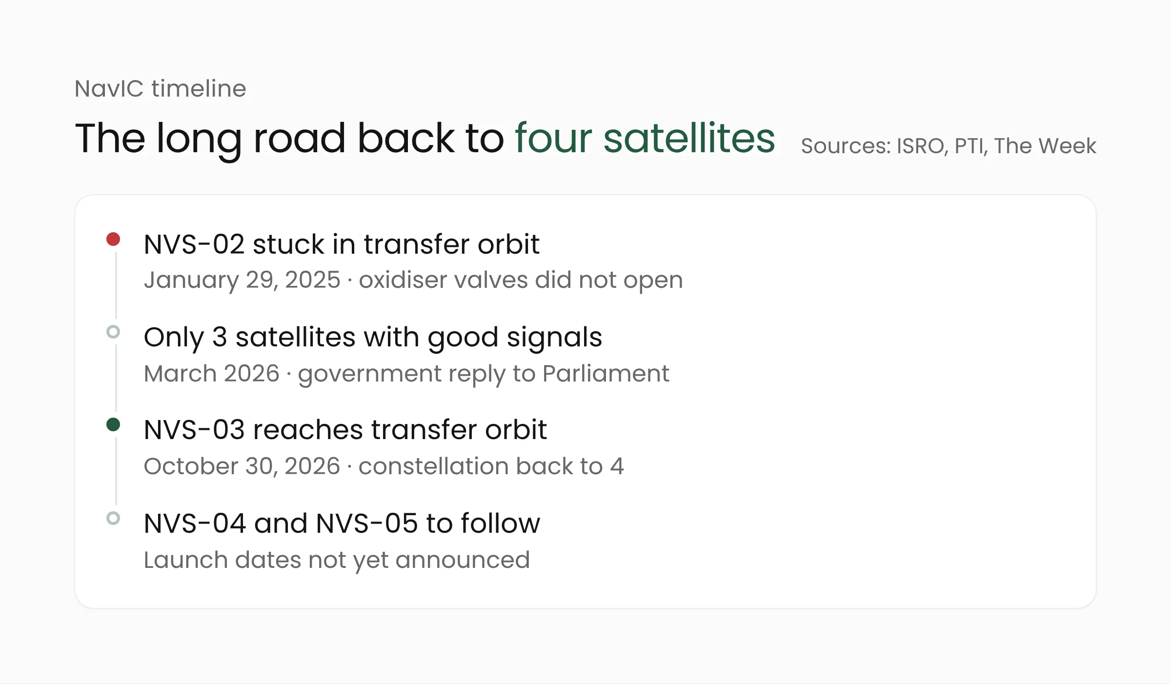
A February 2026 report in The Week described the findings of a failure analysis committee led by former ISRO chairman A. S. Kiran Kumar. The firing signal never reached the pyrotechnic valve on the oxidiser line. According to space analyst Girish Linganna, quoted by the magazine, a loose electrical connection affected both the primary and the backup valves, so the backup failed as well. NVS-02 is still alive, but it remains stuck in transfer orbit and cannot provide navigation service as planned.
For NVS-03, ETV Bharat and PTI reported that ISRO flew the satellite with its pyrotechnic valves already open, a safety step described as unprecedented. For engineering teams in any field, the episode shows that a backup only helps when it does not share a weak point with the part it is meant to replace.
India’s Minister of State for Science and Technology, Jitendra Singh, had earlier told Parliament that NVS-04 and NVS-05 will follow NVS-03, according to The Week. Launch dates for both have not been announced.
What this means for fleet operators and IoT devices
NavIC’s service area is centred on India, so the direct effect on users in Indonesia is limited. The more useful lesson is about how tracking systems are designed. Logistics trucks, ships, intercity buses, mining equipment and courier motorbikes all rely on satellite signals to report their location. The NavIC story shows that a single satellite system can run below full strength for years.
For logistics companies, manufacturers with distribution fleets, or transport agencies that run vehicle tracking, a few steps are worth considering.
- Choose multi-GNSS receiver modules. When buying or upgrading trackers, check the datasheet for which systems are supported and whether they can be used together. A receiver that reads several systems does not depend on the health of one constellation.
- Log position quality alongside coordinates. Store the number of satellites in view and the estimated accuracy with every position report. This helps teams tell a vehicle that has actually stopped from a device that has lost its signal.
- Plan for signal loss. In tunnels, multi-storey car parks or on docks, satellite positioning can weaken. Motion sensors, odometer data or cellular network location can fill short gaps, as long as the system flags them as estimates.
- Check your time source. Many systems timestamp events using GNSS time. Make sure servers and devices have a backup time source so that delivery records, driver attendance and machine logs stay in order.
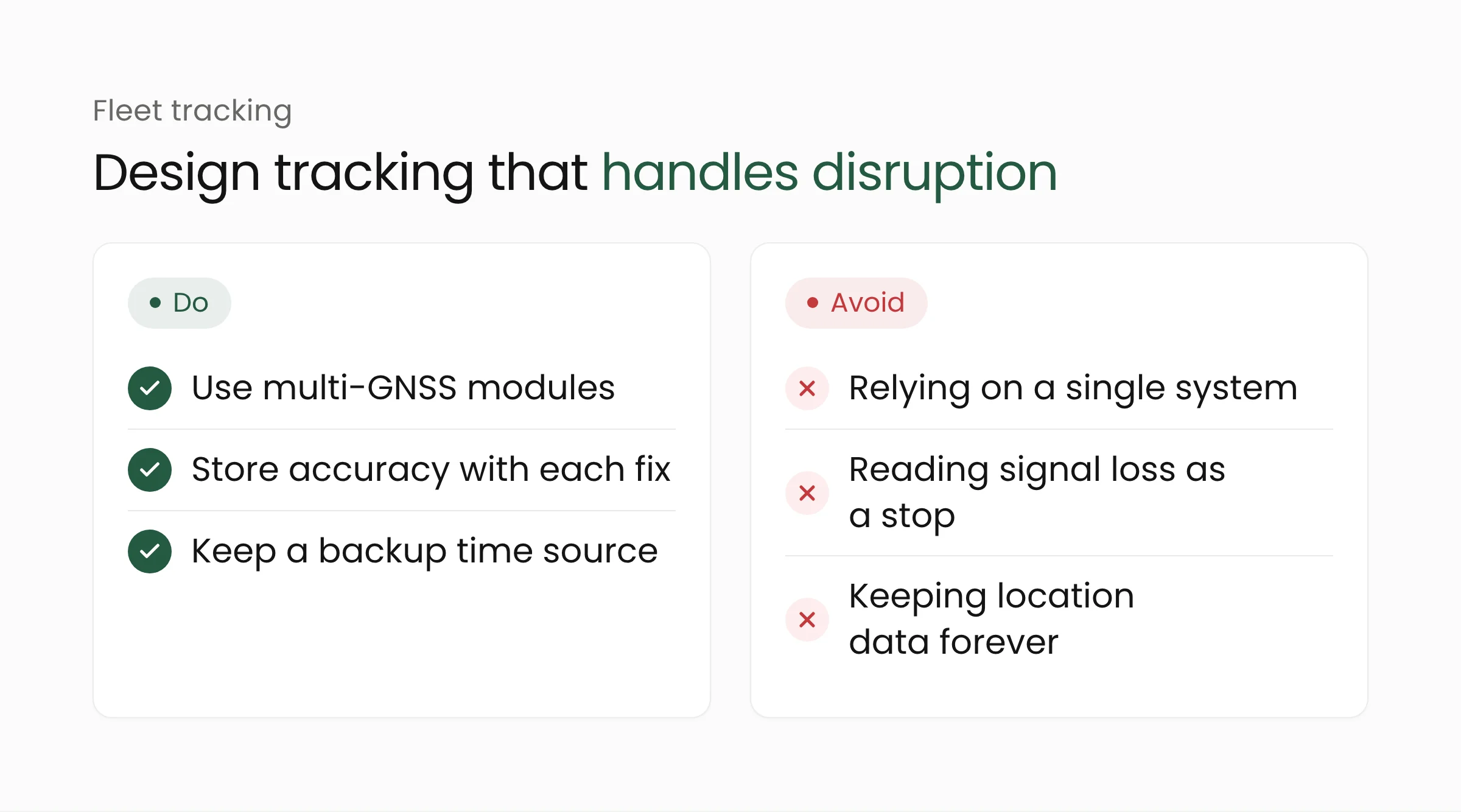
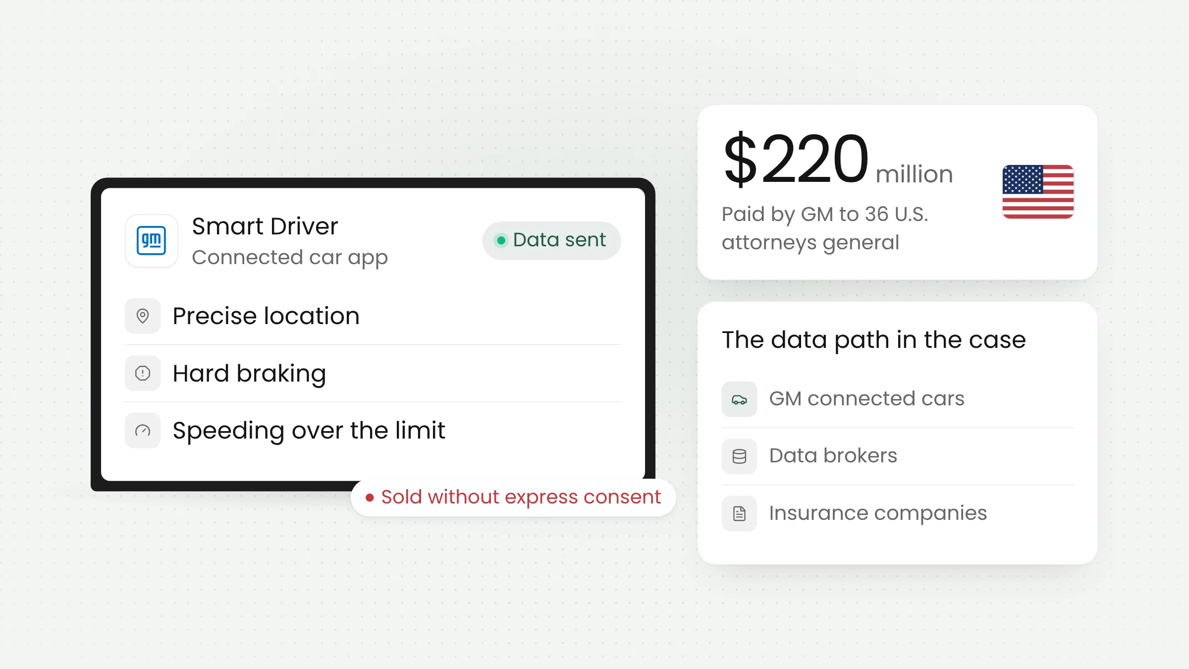
Location data also counts as personal data when it is tied to a driver or a customer. The General Motors driver data case shows that collecting location data without clear consent can end in a costly legal settlement. Design tracking with a clear purpose, limited access and a sensible retention period.
For factories and distributors, reliable position data also underpins the monitoring of goods flows and fleet maintenance. Merakit helps design the devices and dashboards behind this kind of tracking through its Internet of Things services and industrial automation solutions.
Frequently asked questions
Can NavIC be used in Indonesia?
NavIC’s official service area is the Indian landmass and a region about 1,500 km beyond India’s borders, according to ISRO. ISRO does not list Indonesia as part of the service area. Devices in Indonesia should continue to rely on multi-GNSS receivers that read the global systems.
Why does satellite navigation need at least four satellites?
A receiver needs its distance to at least four satellites to calculate its position. Those distances are measured from signal travel time, which is why precise clocks on the satellites matter so much. It is also why NavIC needs four working satellites to keep its service running.
Will my phone automatically receive NavIC signals?
Not necessarily. A phone needs a chip and software that support NavIC’s signal format. The L1 band on the new-generation satellites makes that support easier, because phones already use the band for GPS. Supported systems are usually listed on a phone’s specification sheet.
Closing thoughts
NVS-03’s arrival is good news for India and adds another navigation signal over India and its surroundings. For fleet operators in Indonesia, it is a reminder to check how heavily their tracking depends on a single signal source. If you are planning fleet tracking or connected devices, the Merakit team is ready to help you design them.
Sources
- ISRO: GSLV-F18/NVS-03 Mission (October 28, 2026)
- The Tribune (PTI): ISRO’s GSLV rocket successfully places NVS-03 satellite into ‘designated’ orbit, NavIC constellation restored (October 31, 2026)
- ETV Bharat: ISRO Successfully Places NVS-03 Satellite Into ‘Designated’ Orbit, NavIC Constellation Restored (October 31, 2026)
- The Week: NVS-03, India’s own GPS prepares a strong comeback (August 17, 2026)
- The Week: ISRO reveals the tiny glitch that doomed the NVS-02 (February 26, 2026)
- DigiKey: How to Quickly Implement Positioning Multi-Constellation GNSS Modules (September 9, 2021)